In 2025, I volunteered for the Iditarod Trail Invitational (ITI as everyone calls it), and I had a lot of FOMO watching the Nome-bound folks progress on the trail. April came, and I decided to sign up. Then, in February, I found myself watching the Iron Dog coverage as the teams got stuck in snowstorm after snowstorm, as I shoveled and shoveled… and the snow kept coming. When the ITI finally arrived, I thought there was a 50/50 chance of there being a trail between McGrath and Ruby. McGrath to Ruby doesn’t see much traffic outside the Iron Dog and the Iditarod, and since the Iditarod was two weeks after ITI instead of the normal week, things looked a bit dire.
Nome was a long way off, though…
I figured that even if I had to bail in McGrath, I would still have fun, so on a sunny Sunday afternoon, I was off to McGrath and possibly Nome.
The ride to McGrath was fun. I got to ride with a few new people..
I got to see Tony and Josh, yay! I volunteered in Rohn with Tony in 2024; it was great to see him!
The ride and push over Rainy Pass was fun and beautiful…
I got lots of sleep in Rohn..
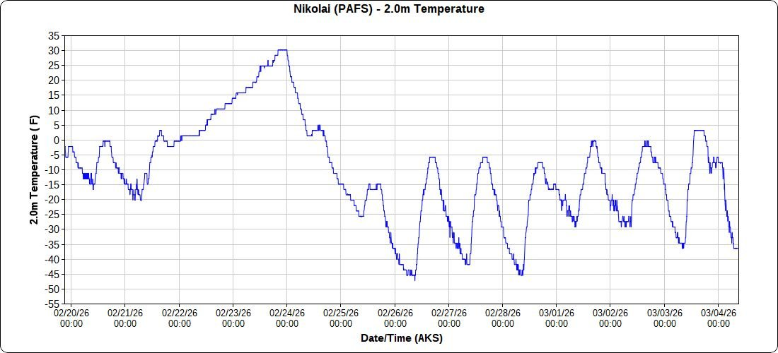
And I got to see Jonathan and Stephanie P in Nikolai P, hurrah! I even got the timing down, so I got mostly good trail from Rohn to Mcgrath.
It was cold, though, the coldest I have seen between Knik and McGrath.
McGrath was less chaotic than normal…
But the trail past Takotna was not in, and waiting 10 days for the dog race wasn’t something I was up for, so I bailed and flew back home to Fairbanks.
Nancy, Eddy the dog, and Sinbad the cat not pictured, but I was glad to see them.
Thanks to everyone who makes the ITI happen. I had fun, just slightly shorter than planned fun. Happy trails, and congratulations to everyone who waited it out in McGrath and made it to Nome.
Molly, Pearl, Eddy, and I slowly made our way up Trembly Creek. Trembly started as a wide valley, but after a few miles necked down into a narrow, steep-sided gulley.
Gradually, we were getting clipped out, until we found the way blocked by a landslide, where the creek wove around swiftly through a pile of rubble. We were stopped! Molly and I fiddled around a bit, exploring options, going back and forth trying to see if we could get around the cliff and over the rockfall, but eventually we gave up and started looking at going up and around. Molly said we should go up river right, and I said river left. After too much discussion, I overruled Molly and we headed up on river left. Up the steep bank we went, pulling the dogs up when it was too steep for them. Eventually, we had a nice view of a well-defined bench on river right that looked like good walking – and of the cliffs ahead of us on the left side that we had to go up and around. Duh! A lot more up later, we could see the nice walking on the other side, well below us, taunting me for my poor decision. Molly only said “I told you so” once. Sigh.
Scene of the poor route choice, dramatized by Molly.
In mid-spring someone emailed a paddling email list I am a member of, asking for volunteers to join in a packrafting trip on the west coast of Alaska to perform stream samples. I checked with my family, and with their ok jumped on it. A few months later, Molly expressed some sadness that she couldn’t come along, as her birding work was done for the summer and she had lots of free time. After some discussion, I bailed on the sampling trip (they were able to find someone to replace me immediately, as it is a really neat trip in a very interesting and infrequently visited area) so I could do a trip with her. Lizzy still had two jobs and Nancy had work and theatrical commitments with a local Shakespeare group, so they didn’t get to join us.
We waffled a bunch on destinations, and I ended up planning three trips in different parts of Alaska, in hopes at least one would have good weather. A few days before the trip the weather looked good in the Brooks Range, so we headed north, spending the night at the Marion Creek campground near Coldfoot. In the morning, we continued north to just before the road climbs up to Chandlar Shelf, and started hiking. We crossed the Dietrich River, and we were on our way!
The trip was an adventure in a lot of ways. A week beforehand, we adopted a new dog, Pearl, from a nearby dog team and she was joining us on the trip with Eddy. Additionally, there were lots of stream crossings on the route and it wasn’t clear how much rain the area had seen recently. I was a bit worried about doing this trip with my daughter Molly – the route was pretty remote, and I felt more responsibility than “normal” trips. I wouldn’t have been that worried if I was solo, or with one of my normal trip partners, which was a new, odd feeling.
Regardless, the trip was a blast! We spent the first night on Trembly, where Pearl got a crash course on the world outside the dog yard.
Her first lesson was that you can fall off of things – she slipped off a small cliff and fell into a pool of water, which caused me to panic, but she emerged unharmed, only very wet. She also learned that the little interesting holes in the ground have things in them when she stuck her nose in a ground squirrel hole and got bitten on the end of her nose. She seemed unconcerned but I freaked out as her face was covered in blood! It turned out that it was just a tiny nick and healed up quickly.
Eddy was also not unscathed – while walking up Trembly we kept finding bits of animal carcasses – sheep fluff, sheep parts, caribou antlers, carabou parts, and an entire dead porcupine – and at one point I wasn’t fast enough to stop him from eating a baseball-sized chunk of sheep fur that had his stomach a bit sad for a few days.
The next day we hiked over to Kinnorutin Pass and camped near a high alpine lake.
Then it was down Amawk Creek to the North Fork of the Koyukuk…
Pearl at this point had become a water crossing princess. If the water looked too deep for her to ford, she would look at Molly or I and give us a “ride, please” look, to which we would pick her up and carry her across. One of the benefits of being 30 lbs! Eddy, being closer to 70lbs, would just get the heave-ho assist, where I would grab the handle on his backpack and lift him up to pull him across. Eddy isn’t a fan of this method, but Princess Pearl loves being carried.
Once on the banks of the Koyokuk, we hiked up the river to the continental divide and camped.
The next day we hiked over to near Oolah pass, seeing our only people of the trip, a small group hiking to Anaktuvik from the highway.
We were a bit ahead of schedule, and the forecast was for lots of rain soon, so on our final day we hiked over Oolah Pass and out on an unnamed creek to the highway. I finished up with a 7 mile bike ride to fetch the car.
Alas, I broke my seat on the ride..
It was a great trip! I was really excited to hike a “harder” trip with Molly, with longer days, completely off trail, and lots and lots of stream crossings. The route went through some truly beautiful country I had been before, and some wonderful places that were new to me. It was also the first trip of this length I had done completely off trail with Eddy, and of course Pearl was new to us and we were just starting to get acquainted. I had gotten a new, bigger tent for this trip (an ebay score, details below!), and we quickly learned that Pearl loves to snuggle in the tent. Eddy is a bit less excited by tent time, but likes it once settled in. Pearl did get very worked up when the marmots and ground squirrels would chirp at us, going into “cracker dog’ mode, where it was hard to get her attention, so she stayed on leash most of the time along with Eddy.
I really want to do do more of these!!
A few words from Molly
I really enjoyed getting to do this “real wilderness” trip, even though I complained about my dad’s route-finding and Pearl’s tendency to always tangle her leash in the brush sometimes. There were practically no mosquitoes at all, the weather was mostly clear, and the scenery was beautiful!
The arctic wildflowers, growing close to the ground, had to have been one of my favorite parts of the scenery. Understated little blossoms that I mostly didn’t know the names for but grew to recognize over the days. I wish I had made a photo journal of every type we saw.
A second favorite part of the trip was going up or down a “molly breaker” hill or a “dad breaker” pass and looking back to see where we had just come from. The distance puts the climb into perspective.
I loved it when we found a game trail to follow because it made the walking a bit easier, but also because it is fun to think about all the caribou, bears, and wolves that walked before you.
I learned quite a bit about the area we walked in from listening to my dad ramble on about famous landmarks, about past trips, and about potential future trips. He has mapped Wikipedia entries downloaded onto his phone for the area, so he could read me professionally curated information about mountains and rivers in the tent at night when I asked. In exchange, I read aloud the novel Artemis Fowl to him. It’s a children’s book, but we both seemed to enjoy it.
I would definitely like to do another trip in the Arctic next summer, but we either shouldn’t take the Subaru, or I need to drive instead of Dad. He kept looking at the scenery instead of the road, saying things like “ooh, it looks like we could hike up that valley there,” and then I would frantically say “pothole!” moments before the poor car smashed into it.
A few other notes..
There were almost no bugs – it was amazing!
In the classic in 2023, I shared an MSR two-person tent with Peter D, and really liked it. It was pretty light (~2lbs), and a “normal” style double-wall tent. In the early summer, I noticed a good deal on old stock 3-person version on ebay. I got it, and am super happy I did – it turned out to work great for two people and two dogs, and it was just over 3lbs. I really like that tent! Alas, the current version is bit heavier, possibly thicker material and normal vs carbon poles, and their lighter 3-person tent is a fair bit smaller. Highly recommended if you can find a NOS version of it.
This is the first road-to-road loop I have done from the haul road that was purely hiking. I was surprised how quickly I could get to someplace interesting from the road. I need to do more of these, as it was logistically simple and fun! I have of course done several road to road trips off the dalton, but nothing “loop” like, were the start and end were so close together.
A few years ago I went to the base of Windy Arch in BLM’s White Mountains in the winter. I had to turn around as Eddy the dog was having trouble on the steep hard pack. I had wanted to go back in the summer, and finally got a chance this spring!
Nome Creek road was closed for construction, so we hiked in from the Wickersham Dome trail…
Where some smoke jumpers were brushing out the trail – which was a huge improvement!!!
Such an improvement – from last year..
And approximately the same area after getting brushed out by the jumpers..
There were signs of last year’s fire..
And a bit of recovery..
We floated a bit of Beaver Creek, camped, and the next morning floated down to near Wolf Run Cabin.
Then hiked up to Windy Arch!
Photo complements of Peter D.
It was very hot – 85f in the shade??
We camped in the Limestone Jags – so beautiful!
And the off-trail walking was the best I have ever experienced in Alaska – fantastic game trails, and wonderful dry streambed walking!
We had a bit of a slog when we had to skip our plan to hike the ridges back to Beaver Creek.. but it wasn’t horrible, just not great..
And it did end.. yay!
The last day we hiked the Summit Trail out, dodging thunderstorms, and just making it out before a big one came in. A few days later, the whole area was closed due to two fires likely started by those storms. Summer in Alaska alas!
This trip was a blast, but if I was to do it again (which I might, the better parts were really scenic! ) – I would float from ophir creek campground to where Fossil Creek enters Beaver Creek, hike up into the Jags, then out either over Cache Mt or the divide. That would mostly have good walking, and miss the tussock slogs part. I hope everyone is enjoying summer!
When we arrived in Kiana, there was only a faint trail out of town. After spending the night in the school we slept in late, hoping the dog race’s trail crew would leave before us and put in a trail. As we rode out of town and down onto the Kobuk river, there was lath marking a trail out of town – yay!! We puttered along slowly, grinding away on a soft trail across the main channel only to find the trail turned around – doh! And back we went, slowly grinding back to town..
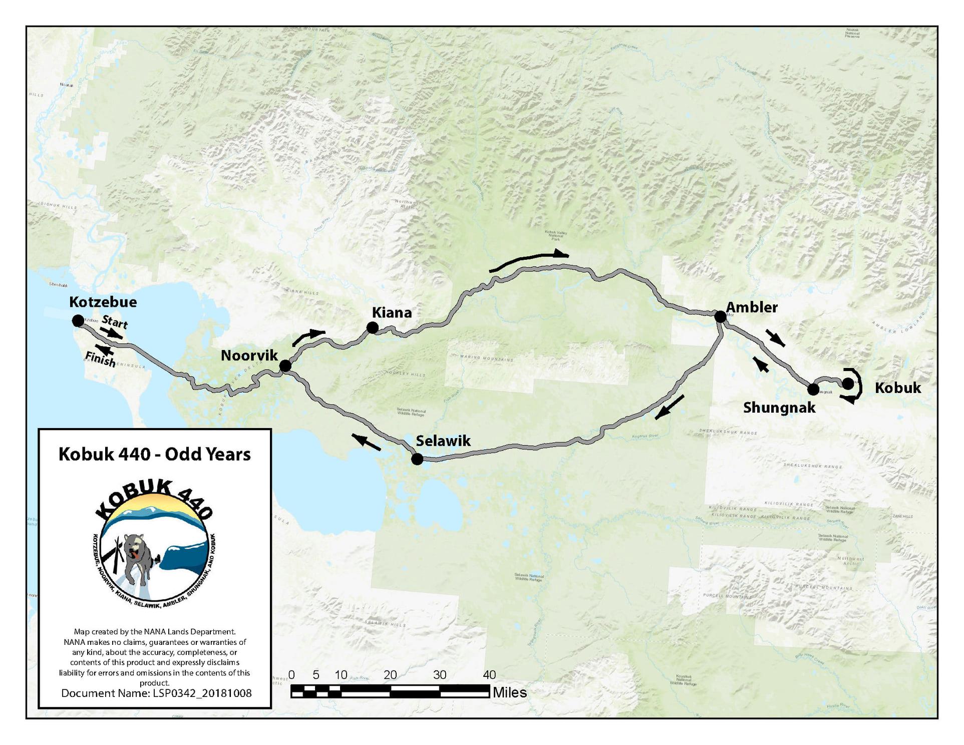
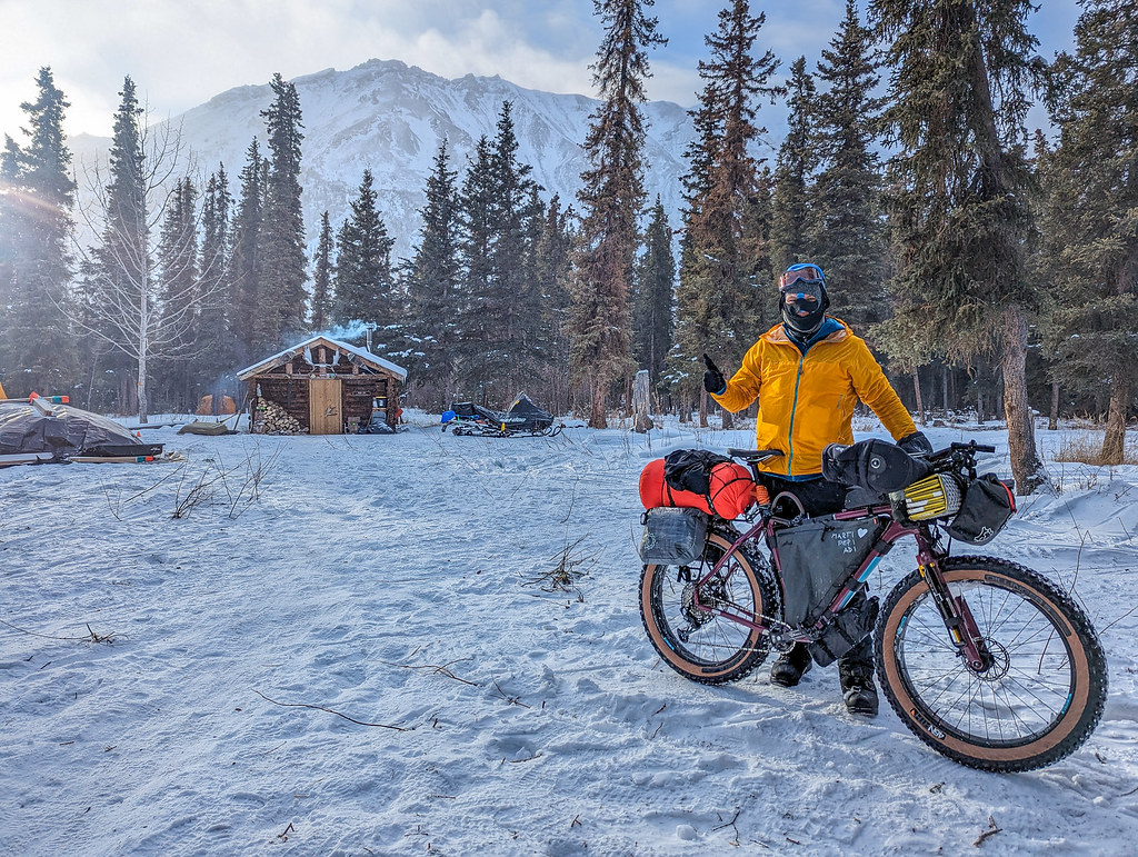
In 2023, Bill F and I talked a bit about biking the Kobuk 440 route. The Kobuk 440 is a dog sled race that goes from Kotzebue to Kobuk, then back, and is semi-legendary for bad weather.
Kobuk440 route, from the Kobuk 440 website.
It is well above the Arctic Circle, and the temperatures can be quite cold, but by early April it should have lots of daylight.. We had tentative plans to ride the route in 2024, but those fell through. Which was possibly for the best, as the dog race was delayed a few days due to a big storm system coming in. A friend was in Kotzebue teaching kids to ski for Skiku when the dog race was supposed to start. The wind was so strong that school was canceled. Kotzebue is a really windy place, so for school to be canceled, it must have been horrific!
With that gloomy backdrop, this year we tried again and were joined by Spencer M. We arrived in Kotzebue on the last day of March, and we flew right over the trail as we landed. I had never been north of Nome on the coast, and spent the last part of the flight with my head pressed against the window looking out for the trail, which wasn’t to be seen. The treeless alien wasteland was pretty intimidating, but I guess that is what the adventure is all about! After spending the rest of the day getting the bikes ready to go and doing a bit of exploring in Kotzebue, we left the following day, April 1st.
Leaving town was a bit confusing, but we were soon on the right trail and on our way – the start of a new adventure in a completely new place, hurrah!
We spent most of the day biking to Noorvik, enjoying a wonderful sunny day with a brisk tailwind. It felt a bit like being on the planet Hoth from Star Wars – snowy, treeless, and exposed. Crossing Kobuk Lake topped things off, and I could almost hear the Imperial walkers stomping in the distance..
Fortunately, as we got closer to Noorvik, trees started to return.
We arrived in Noorvik in the early evening, when a regional basketball tournament was happening, and I enjoyed a healthy dinner of nachos and hot dogs from a stand the local kids were running. Alas, I was thinking we would make it to Kiana, but we were going slower than anticipated – a bit of a theme for this adventure, hah!
Day 1:
Distance 47.88 mi
Elevation Gain 725 ft
Moving Time 9h 29m
The next day we headed out into a snowy morning and slowly rode to Kiana, where we found the trail ended.
The folks in Noorvik had said that the trail from Kiana to Ambler doesn’t see much traffic, and I guess they were right. There was a faint trail, but it was well covered with snow, and it would have been slow pushing.. We stopped by the school and they put us up for the night. I was able to get pizza, pie, and other snacks from the store, hurrah! We went to bed with plans to head out in the late morning in hopes the dog race would have someone putting in a trail.
Day 2:
Distance 23.10 mi
Elevation Gain 285 ft
Moving Time 6h 1m
We packed up and headed out in the late morning, enjoying a leisurely morning in hopes there would be a trail when we left. On the way out of town we passed a group with the National Park Service who were heading out to staff the Portage / Tutasraq shelter cabin. Things were looking good! There was even a trail out of town marked by lath!
Alas, it ended a quarter of a mile out of town, and we turned around and went back to hang out at the Blankenship store and eat snacks. I looked out at every snow machine that passed by in hopes one would be the NPS heading out, but no luck. Eventually, I walked down to the river and a group on big machines went by and parked out where the trail ended, chatted, then took off and headed out. We spent most of the day riding slowly on very soft trail, enjoying the sun and hoping for better trail.
The trail slowly got better as the traffic increased, and got quite a bit better when a group went by pulling a big machine on a sled.
Eventually, the trail went close to the bank and we found a good place to bivy for the night. Just after sunset a group of snowmachines passed by with the dog race and stopped and chatted for a bit.
Photo complements of Bill Fleming.
I drifted off enjoying the northern lights, and in the early hours of the morning I was woken by dog teams passing, though I was too lazy to get up and cheer them on.
Day 3:
Distance 28.13 mi
Elevation Gain 292 ft
Moving Time 9h 50m
In the morning we packed up and enjoyed some nicer trail… until it started snowing again, and things slowed down. We passed by the Portage or Tutasraq cabin where we ran into our first mushers, and chatted a bit with the NPS folks who were camped nearby and were keeping the cabin warm.
Get all of me in the photo – Quince Mountain while taking photos of his mittens as booties cabin footwear. Mushers like Quince give me hope for humanity..
By evening our progress slowed down a fair bit in the new snow, and we camped in some bushes just off the trail a few miles from where the author Seth Kantner grew up.
Day 4:
Distance 40.29 mi
Elevation Gain 876 ft
Moving Time 10h 1m
In the morning the wind had died down, but it was still snowing lightly.
So many ptarmigan!
We rode slowly the rest of the way into Ambler, where we were excited to hear there was a place that served food – yay!
We stayed at the school, and given our slow progress, decided to see how the trail was to Kobuk – if we could make it there we would call it good.
I was super amused by a poster with Iñupiaq seasons on it, with two springs – which seems very logical from my Fairbanks perspective. In early spring it is sunny, with warm days and cold nights and the best part of the winter. Late spring it is warm all day, mushy, and gross, and the worse part of the year.
Day 5:
Distance 18.61 mi
Elevation Gain 735 ft
Moving Time 6h 21m
We headed out of town after agreeing that if the trail was bad, we would turn back. The trail started slow but ridable, but gradually switched to mostly walking with short sections of riding.
There was lots of joking about the “well-used trail” the locals talked about. We didn’t see anybody. There were lots of clouds, and I couldn’t see the mountains and views the folks at the Noorvik basketball tournament told us about, alas. However, I did enjoy a nice long walk with the bike. Almost a marathon of pushing, hah!
We spent the night in the Shungnak school, where the principal gave us Shungnak hoodies!
Day 6:
Distance 26.17 mi
Elevation Gain 404 ft
Moving Time 10h 50m
On our final day, we rode on a much better trail for the 9 miles to Kobuk.
We had spent the afternoon and evening before in Shungnak talking to the kids and hanging out with locals. Folks seemed pretty interested in chatting with us about our ride. I learned that there are several Iñupiaq dialects in the area, and the language spoken by the folks in Noorvik (coastal Iñupiaq) is different enough from what is spoken in Kobuk (inland Iñupiaq), the locals weren’t able to tell us pronounce place names in a dialect spoken in the other region. I was super impressed how the local languages are apparently still in use! Keeping a language alive that is only spoken in three villages with a total population of under 2k is an amazing achievement!
Day 7:
Distance 8.92 mi
Elevation Gain 223 ft
Moving Time 2h 31m
The following afternoon we flew back to Kotzebue (morning flights having been canceled due to weather), and I flew back to Fairbanks via Anchorage the day after that.
Thanks for the adventure Bill and Spencer, it was great traveling with you!
—
Notes:
This trip was super fun, and it was great spending time with Bill and Spencer!
Bill did most of the logistics for this trip, and contacted the schools in advance and got us permission to stay in them, and for Noorvik and Ambler, permission for us to send resupply boxes. It was generally $150 a night per person, and the schools were all pretty friendly.
The trail was very slow after Noorvik. It didn’t appear to be getting much traffic between Kiana and Ambler. We saw lots of traffic between Kotzebue and Noorvik, but otherwise we didn’t see many people on the trail.
The riding was mostly slow, but we had pretty good weather. It snowed most days, but we didn’t have any hard wind storms. It is very exposed from Kotz to Noorvik, and could be miserable if a storm came in.
The trail conditions were slow and soft for the most part. The locals say that it generally snows when the Kobuk 440 is happening, so maybe this is normal for this time of year.
The route was scenic, but it had a lot more river riding than I expected – which is my own fault, as I had a map. It was also very cloudy with limited visibility for a lot of the ride, so I had fewer views of the mountains than I would have liked, but such is life.
Everyone was very friendly!
There are flights twice a day from Kotz to all the villages on our route via Bering Air, as well as frequent flights from Kotz to Anchorage. Direct lights from Fairbanks to Kobuk, Shungnak, and a few other villages are available, although these are only offered a couple of times a week via Wright Air, and are not listed or advertised. Ryan Air handles freight (the bikes) in all these communities.
The hotel in Kotzebue is super nice!
The local native languages (Iñupiat dialects) were everywhere! It was really exciting to see the local languages are alive. The principal in Shungak said the students didn’t like going to their Inupiat classes, so maybe it is an uphill battle, but it is still very refreshing to see.
Skiing this route later in the year might be fun. Ned Rozell and Andy Sterns did that years ago and had a great time.
For anyone thinking of doing this route, it isn’t a beginner’s trip. It is very remote, and can be extremely cold and windy, with little traffic.
This was the first trip in a while where I wished for tires with more tread. I had big tires, HD 4.8s on wide rims, but with low-profile tread, and I think something with a bit more bite to it in the front might have worked better. And maybe an even bigger tire. We joked a bit about the new gearbox fat bike Surly is making, maybe that would have been ideal, or maybe not.
The family and I did the classic Beaver Creek float and hike. Jokingly I suggested to my daughter Lizzy that she write a blog post about it for me. Amazingly, she agreed – enjoy!
In a story that was told during one of the Dark Winter Nights productions it was stated that something truly was terrifying because Jay Cable started screaming, and he never screams.
I can say that this is factually false. My dad screams more than probably anybody else I know. Multiple times I have had to tell him to not scream unless he is actually seriously injured because otherwise, nearby people will come running to witness the terrible injury, which would be embarrassing for both him and me.
Note: The dark winter nights episode Lizzy is refering to can be found here: (Also, I never scream. -JC)
The beaver creek trip I went on this summer, luckily, did not include very much screaming, except for a few moments. The weather was fairly perfect, with almost no bugs.
The packrafting was definitely not hot, but also not the frigid hail-filled adventure a previous beaver creek trip was. We had one day of packrafting, then stayed at a cabin for the night, then crossed the creek again to get to the trail on the other side. I was boating in a tricolor boat and took joy in paddling far ahead from the rest of the group so that I had to be shouted at to wait.
Lizzy, in the “tricolor boat”.. Lizzy, in her natural habitat..
The wildlife from the creek was quite impressive. We saw multiple eagles and ospreys, plus a porcupine and a moose. Bank swallows were also a continual presence later during the boating.
Summer cabin life.. Lizzy, the young author of this screed, appreciating the aroma of her well aged socks..
The short journey away from the cabin on the second day turned out to be an unexpected source of adventure. I got across perfectly fine in my boat, which I then deflated and rolled up to go in my dad’s backpack. However, there was a shriek from the middle of the creek as my dad was crossing. Apparently he had a thermos of coffee in the boat which had a poor lid, or a lid he had forgotten to actually screw on. Whatever the cause, he was soon sitting in a pool of coffee that had filled the inside of his raft.
When he got out of the boat the seat of his pants was soaked. There was also a very strong odor of coffee as he walked past. He quickly changed into different pants and underwear. However, he then asked the family to wash both in the creek. I refused and ran in the opposite direction. Finally, he was forced to wash his own clothing, and then changed into dry shorts.
It wouldn’t really have mattered if he had kept the original shorts on. He had told us that there would be a creek crossing after the first, but that it would be shallow and that we would just walk across. It was not shallow. It was thigh deep on my dad, waist deep on me. I told my dad he had to come back and take my backpack for me. I had assumed, on a day we wouldn’t be boating, that I wouldn’t need to seal everything into a dry sack. Apparently, on all hiking trips it is best to assume that you are going swimming.
The trail on the first day of hiking wasn’t terrible, but it wasn’t great either. The brush, unfortunately, in some locations was densest beside and in the trail. The brush would grow specifically in the trail because water would flow down it. Specifically the two miles after the trail shelter, or before the trail shelter from our perspective, are very brushy.
When we reached camp I entertained myself by reading the two books I brought, both of which I finished during the trip. I was very appreciative of the large supply of camp chairs in the trail shelter.
The third day, while being the shortest, was somewhat frustrating for me. My wet feet and poor shoes generated blisters. I was also carrying the largest kayak paddles, which stuck out from the top of my pack and caught on all the brush.
Why, what big paddles you have Lizzy!
My spirits improved near the end of the hike, and I was pleased with myself once I reached the parking lot and took my shoes off. I also have an appreciation now for my hatred of coffee. I will never end up with coffee packraft crotch.
Nick J from Fairbanks had just arrived, and I was helping him get his boots out of his ski bindings. We got them off and headed into the wall tent which is the Iditarod Trail Invitational racers’ lodging while in Rohn. Just after entering the tent, there was a big gust of wind, and with a loud bang, the chimney blew off, followed by one of the walls blowing in. I asked Nick to hold the wall down, then ran to go wake up Adrian to help fix the stove. With Adrian’s help, I got the stove back together and then got the wall firmly tacked down again, and Nick got to sit down and enjoy his brats, soup, and hot Tang.
Another evening in Rohn!
In 2013 I was welcomed into Rohn by Rob Kehrer. He fed me, dried my stuff, and offered me as much pilot bread as I could eat. I was so thrilled by the unlimited pilot bread! Ever since then I have been looking for a chance to give back, and in mid-January someone from the ITI posted to Facebook saying they needed someone to volunteer for Rohn. I responded, and I was in – after checking with my boss and family.
Rob and O.E., in 2013
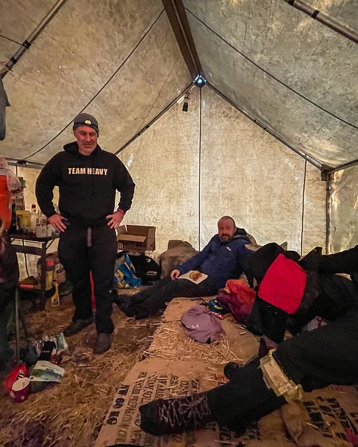
Me, 11 years later, wearing a “Team Heavy” sweatshirt and thinking of Rob. Photo compliments Laura R.
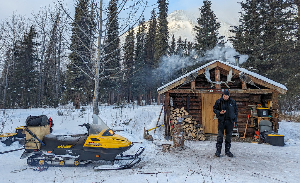
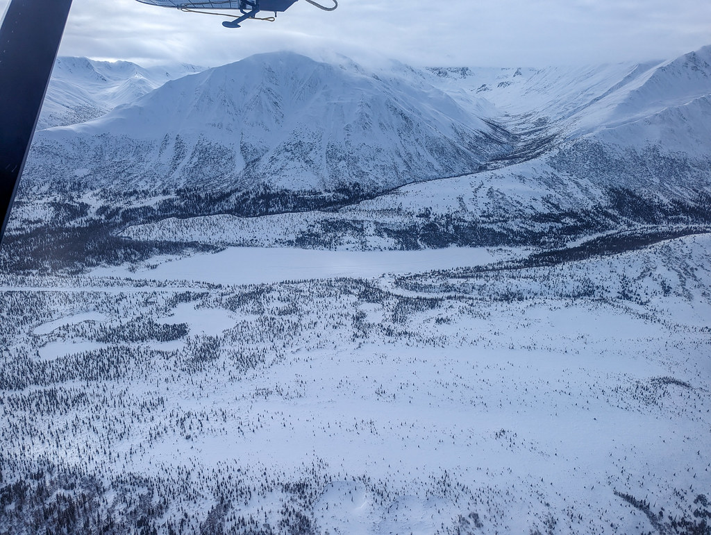
A few weeks later I was boarding a Beaver with my fellow volunteer Tony, and we were off to Rohn. The flight was beautiful!
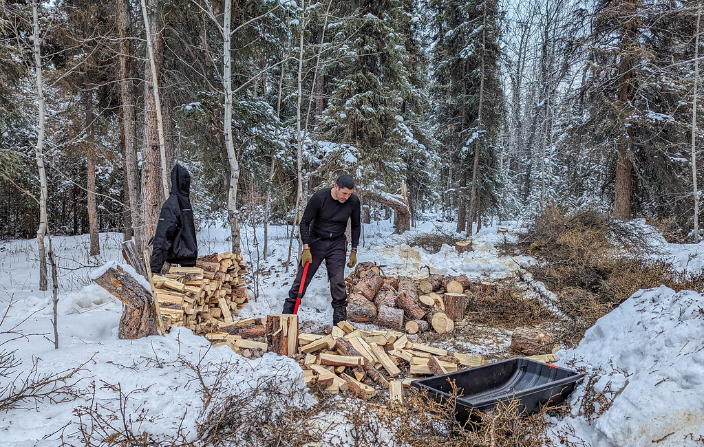
The next few days were a bit of a blur directed by the ITI’s Adrian – putting up tents, splitting wood, moving things around, etc, as we got ready for the racers’ arrival in Rohn. Sam and Brian, who snowmachined in from the Willow area with Adrian, were wood-cutting machines. So much firewood was cut up! Adrian served more meat with breakfast and dinner than I have had in years.
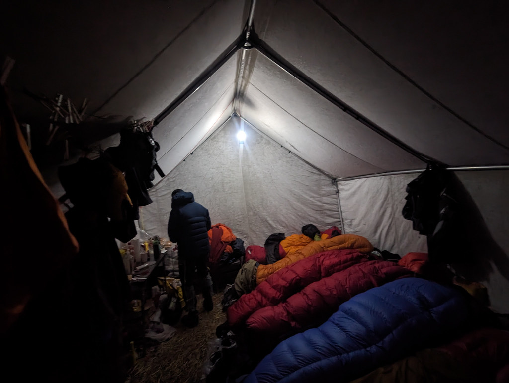
The Rohn wall tent is ready to go!
Tony, ready to cook brats!
Banner ready!
Rohn cabin ready!
Tony, splitting wood like a mad person!
The first to arrive were Clinton and Kevin, followed by a continuous stream of other people.
Clinton, first in!
Kevin, second!
Kevin, under the banner!
Tang and hot chocolate..
It was the beginning of five days of chaos. Fortunately Tony is a night person, and he was willing to do the night shifts, while I did the mid-morning to midnight shift. It worked out (at least for me, Tony might disagree as he did all the night shifts). Soon we were settled into the routine of feeding racers, handing out hot drinks, drying their stuff, stocking the wood stove, preventing racers from hurting themselves or wrecking their stuff on the wood stove, etc. After a while I felt a bit like a crazy laundry person, always drying stuff! It soon became just a blur.
Drying boots.. well labeled?
Laundry up with a full house..
P.B. resupplying..
It was great seeing the racers though, and I got to see Petr, Nick, and other folks I knew from past trips on the Iditarod trail as they passed through. There was a strong Fairbanks contingent and it was great to see NIkki, Aaron, and Ben!
Aaron ready to head out
Aaron showing how he can get a whole bag of doritos in his snack bag – I was impressed!
Tomas! He was a rookie, and rode from Rainy Pass Lodge to Nikolai (and possibly Mcgrath) solo!
And it was great to see Steph who I met in an Alaska Summer Wilderness Classic years ago – I didn’t know she was doing the race!
At times it was fun. I really enjoyed catching up with the various people I have traveled with in the past. At times it was frustrating – as when I had to prevent someone from putting plastic containers on the (very hot) wood stove to warm up. The wood stove was an issue, as people didn’t seem to understand how hot it was, and how fast things melt, heat up, etc. At times it was a bit depressing, mostly when helping folks dry out their gear. At one point I was handed a fancy down jacket that was oddly heavy with weirdly chunky, hard, and large things in the pockets, only to discover the chunky things were frozen chunks of ice inside it – the jacket was soaked, and had several pounds of frozen water in it. Coming in with puffy layers soaked with frozen sweat was oddly common. Really folks, if you are sweating out your puffy layers you need to take them off. Mike C puts it best – don’t sweat. In another case it took over 20 minutes for someone to get his facemask off, having frozen it to his beard – i have no idea how he ate or drank before getting it off. Maybe he hadn’t eaten most of the day. Partially frozen Hydro Flask style bottles were also common. It is odd they are so popular, they are not really all that good at keeping beverages warm.
Eventually, things died down, and the last racers, Doug and Sunny, were off. I missed Sunny’s departure, but I walked Doug to the edge of the trees and saw him off.
Doug, heading out. He let out a huge whoop just after I took this photo – I don’t think he believed me how nice it was going to be – sunny, warm, with a fantastic view!
Some regrets: the Rohn tent only sleeps eight people, and there is supposed to be a first-in-first-out policy. I tried to be nice about kicking folks out, but it always backfired and just delayed the whole process. I should have just kicked folks out ASAP to speed up turnover. A huge thank you to everyone who just slept outside when the tent was full, or quickly got out when asked, it was really appreciated! Live and learn.
It was amazing to me how busy things got. While racing, I had only shared the tent with four other people at most, and several times had the place to myself. At one point there were thirteen people in the tent including me: eight sleeping, and five standing or sitting – totally crazy!
As things wound down, some of the Iditarod staff at Rohn suggested we stay for a few days and volunteer for the dog race. A quick check with my family and with work (thanks for ghostwriting my Inreach message to work Laura!) and I was staying for the Iditarod.
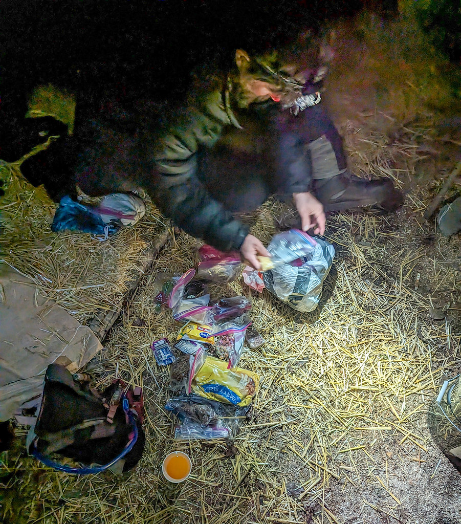
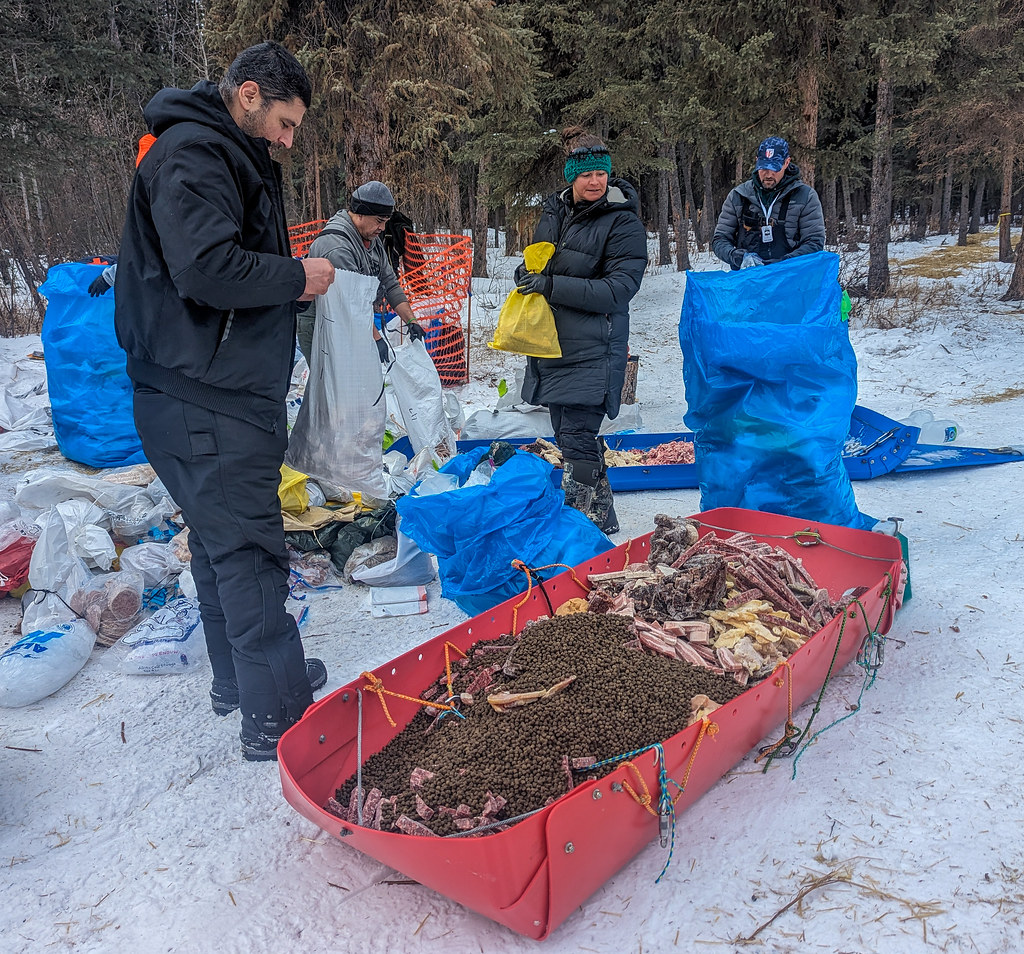
In a bit of a sleep-deprived haze I sang to the dropped dogs while ladling soup made out of chunks of meat, fish, fat and kibble taken from mushers’ leftovers.
“Yum, yum, so good to eat, Mystery Meat”
The newer dogs looked at me like I was crazy, while the dogs dropped earlier looked on excitedly for their chance for a yummy ladle of meaty soup.
“Mystery Meat, Mystery Meat, everyone loves Mystery Meat” Who knows what the vets resting in the nearby tent thought…
Rohn, in the middle of dog race madness..
Volunteering for the Iditarod by staying on at Rohn was a bit odd – there wasn’t any paperwork, I was never given any rules or anything, so I wasn’t quite sure what was allowed and not allowed. However, it started just like the ITI – lots of moving stuff around and getting ready – sorting drop bags, counting drop bags, putting up lights, etc, etc. Eventually, other volunteers showed up, including vets, race materials, and other random people like me.
Mike, waiting for the action to start
Rohn, all ready to go – just needs dogs!
The first sign of the actual dog race was when the Iditarod trail breakers arrived. It was a bit odd to see them and not really care that much – normally I am eagerly waiting for them in hopes for a better trail – or any trail at all.
The Iditarod trail breakers passing though..
Eventually, the dog teams started arriving and then it was busy – moving stuff, parking teams, getting water, helping with dropped dogs, and doing other random tasks. I ended up spending a lot of time with the dropped dogs. The dogs dropped for overuse injuries (“orthopedic” I think the vets called it) perked up quickly, and started wanting attention and love. The first two dogs dropped, a mixed-color male, and a darker-colored male, whose teams I don’t remember, and a dog dropped later, “China Cat” from Paige’s team from Squid Acres, in particular, were love bugs.
I am horrible at names, and even worse when sleep-deprived. After around 20 hours of mostly nonstop activity, the last dog team left, and the cleanup began. After the last dog team took off, there was a brief lull as everyone took a moment to relax. While staring off into space I noticed the vets had all disappeared, so I went to go track them down and found them raking straw up in the dropped dogs area. This sort of blew my mind – instead of taking a break, and getting the next flight out (vets are in demand, and three of the four at Rohn had assignments at other checkpoints after Rohn), they were off cleaning up and setting an example. Shortly after that, everyone else started raking straw and cleaning up.
Cleanup..
After the last dogs left, a person on an Elan from the mid-1970s showed up. It turns out it was Lance, whom I met in 2016 when he was taking a mid-80s Bravo to the north slope via the Iditarod trail. He said the Bravo was much nicer.. Lance is touring the Iditarod trail using all 1970s vintage gear. He looked quite tired out!
The next day was spent tearing everything down and packing everything up, and the following morning Tony and I flew out.
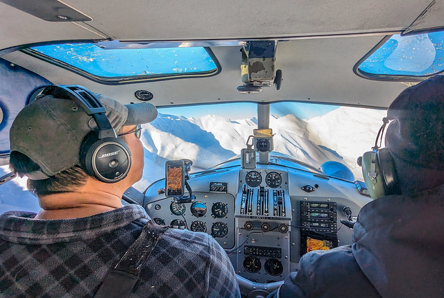
Tony used to help run AWACs for the Air Force and had a blast talking with our pilot about the various gadgets on the plane on our flight back, as well as sightseeing and looking for moose and wolves.
Rainy Pass Lodge!
Enjoying the new fangled aviation gadgets!
All in all, it was a great experience! My apologies to anyone whose name I repeatedly got wrong in my sleep-deprived haze. I think I randomly started calling Tony “Antonio” at one point.
It was great spending time with everyone at Rohn. Tony, Adrian, and the rest of the crew are fantastic human beings and it was great spending time with you all!
My apologies to anyone I forgot the name of called the wrong name, all the burned brats, and anything else I might have messed up while out at Rohn!
I would like to thank Steph the vet tech and NOLS instructor for her help inspecting various frostbitten parts and help calming down the traveling partners of folks with frostbitten parts – thanks, it was appreciated! A big thank your to the people behind the ITI – thanks for making it happen, and thanks for letting me be part of it for a year! And of course my family for letting me disappear for two weeks!